
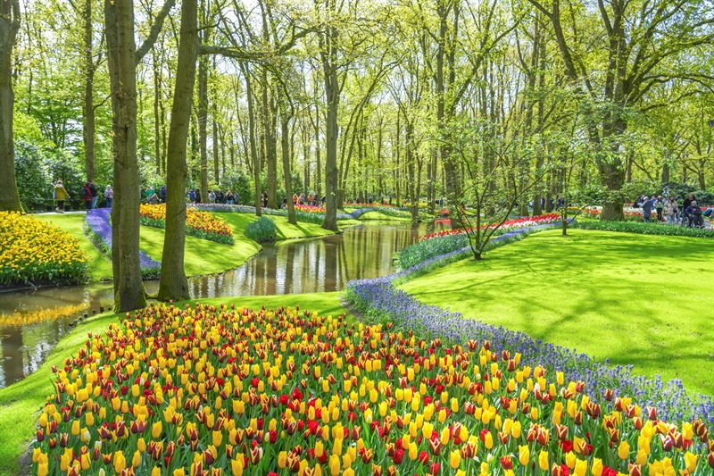

View the Keukenhof map
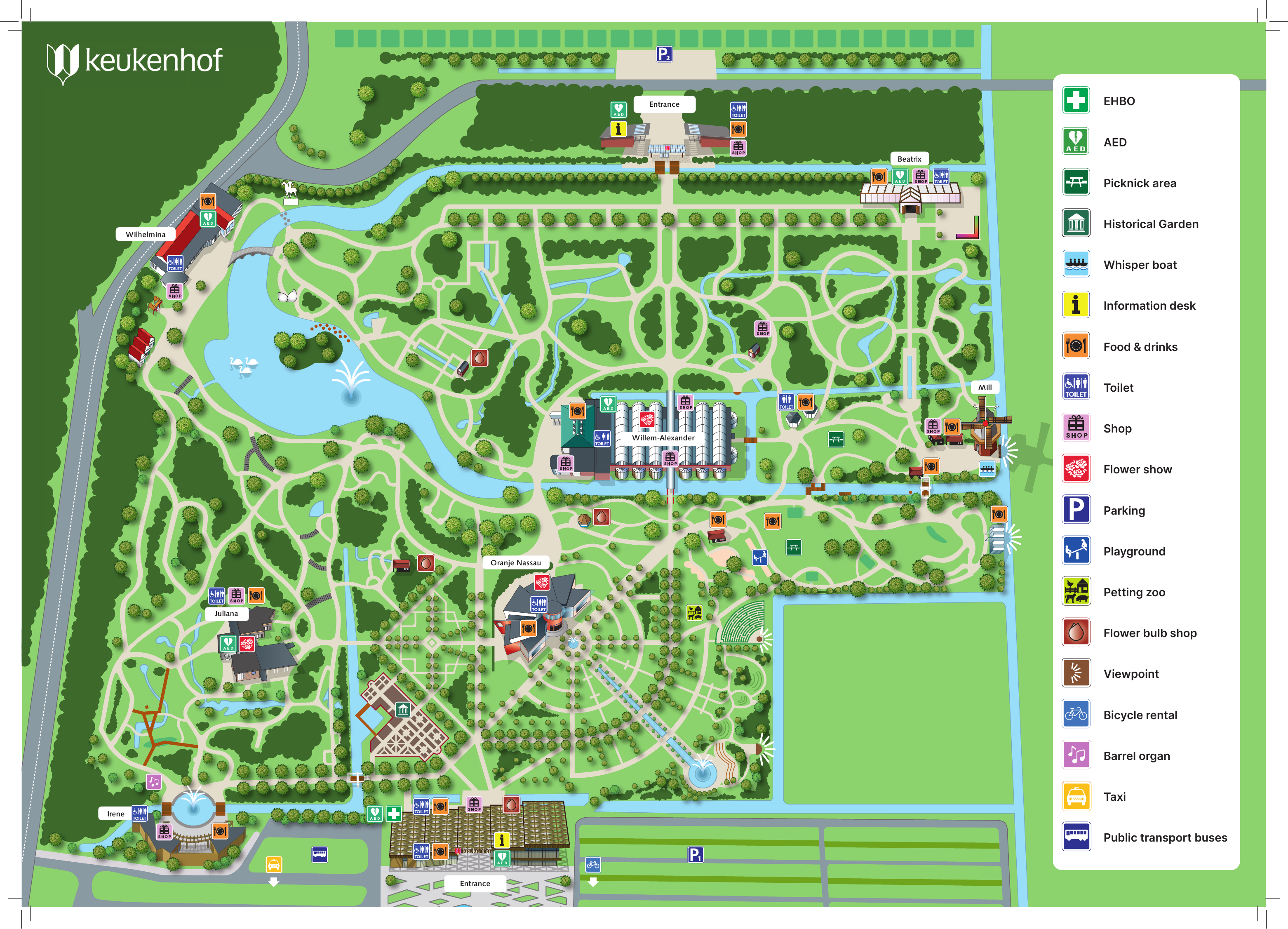
The map below shows the garden layout, entrances, major pavilions and visitor facilities. Tap or open the image if you want to inspect it in more detail.
Main pavilions on the Keukenhof map
The map marks several important pavilions that are useful as orientation points while walking through the gardens:
- Willem-Alexander Pavilion – one of the largest central buildings on the map.
- Oranje Nassau Pavilion – located in the central-southern part of the gardens.
- Juliana Pavilion – shown on the western side of the park.
- Irene Pavilion – close to the southern entrance area.
- Beatrix Pavilion – shown in the north-eastern part of the gardens.
- Wilhelmina Pavilion – marked on the western side of the park near the water.
These buildings are useful meeting points if your group separates during the visit.
Toilets, food, first aid and visitor facilities
The map legend identifies the main practical facilities throughout Keukenhof:
| Facility | What the map shows |
|---|---|
| Toilets | Toilet locations are marked at several points around the park. |
| Food & drinks | Food and drink locations are marked across the gardens close to major visitor areas. |
| Information desk | Information points are shown near visitor hubs and entrances. |
| EHBO / First aid | First-aid locations are identified with the EHBO symbol. |
| AED | AED locations are also shown separately on the map. |
| Shops | General shops and a flower bulb shop are identified in the legend. |
| Parking | Parking areas are marked outside the main garden area. |
Facilities for families with children
The map marks both the Keukenhof playgrounds and the Animal Meadow. These are useful stops if you are visiting with younger children and want to break up the flower displays with a different activity. Note that the Animal Meadow is viewed from a distance; visitors cannot enter the enclosure.
Special family date: Miffy (Nijntje) is currently listed to visit Keukenhof on Wednesday 14 April 2027. See the complete Miffy Day guide →
Other attractions and useful map symbols
The legend also includes several attractions and practical services that visitors may want to locate in advance:
- Historical Garden
- Whisper Boat
- Flower show
- Viewpoint
- Bicycle rental
- Barrel organ
- Taxi
- Public transport buses
- Picnic area
How to use the map during your Keukenhof visit
Keukenhof is large enough that it helps to choose a few landmarks before you start walking. A simple strategy is to use the major pavilions as orientation points, check where you want to stop for food or toilets, and then leave room in your route for the outdoor gardens and seasonal flower displays.
If you are travelling on the Keukenhof Flex Return day trip from Amsterdam, you do not have to rush through a fixed garden route. The last return bus leaves Keukenhof at 19:00, so you can use the map to plan your own pace.
Use the map to find the Keukenhof pavilions
The main pavilions have very different roles: flower shows, orchids, restaurants and rest areas. Read our complete Keukenhof pavilions guide to decide which ones to include in your route and where to stop for food.